What Happened to America When Pangea Tore Apart?
Jun 01, 2026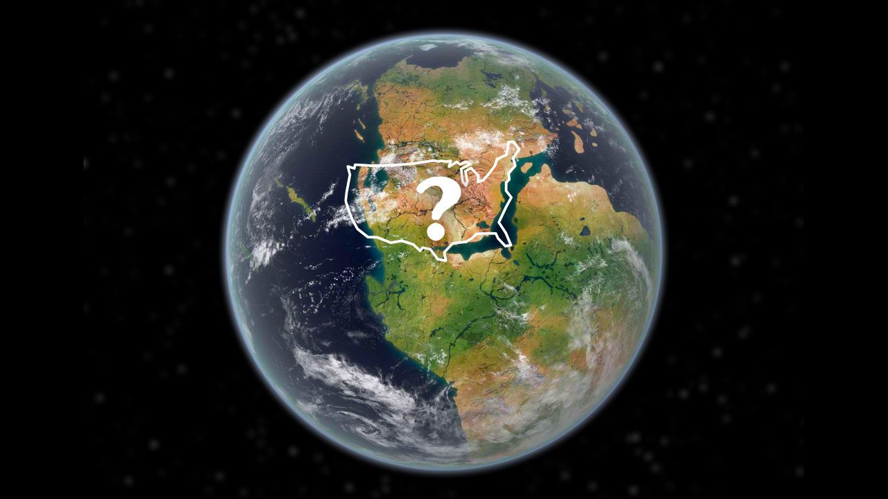
By: Greg Schmalzel
250 million years ago, there was no Atlantic Ocean. If you were standing in New Jersey… you could walk right to Northwestern Africa, probably Morocco. There were no waves or coastline in between. Just a continuous landscape stretching across what are now two independent continents. But beneath your feet, something was beginning to change. The ground was thinning and cracking. It was being pulled apart by forces deep within the Earth. What may have started as some subtle fractures would become one of the most violent geological events in our planet’s history. The land you were standing on was called Pangea, and it was about to change dramatically.
The continents as we know them today split from this ancestral landmass, and in this video we’ll be exploring what happened to America specifically. We’re going to investigate what Pangea was and how it formed, why it split apart, the magma basins and oceans that grew out of the event, and the surprising downstream effects it eventually had on people living in America.
To watch the full YouTube video, Cclick HERE.
What was Pangea?
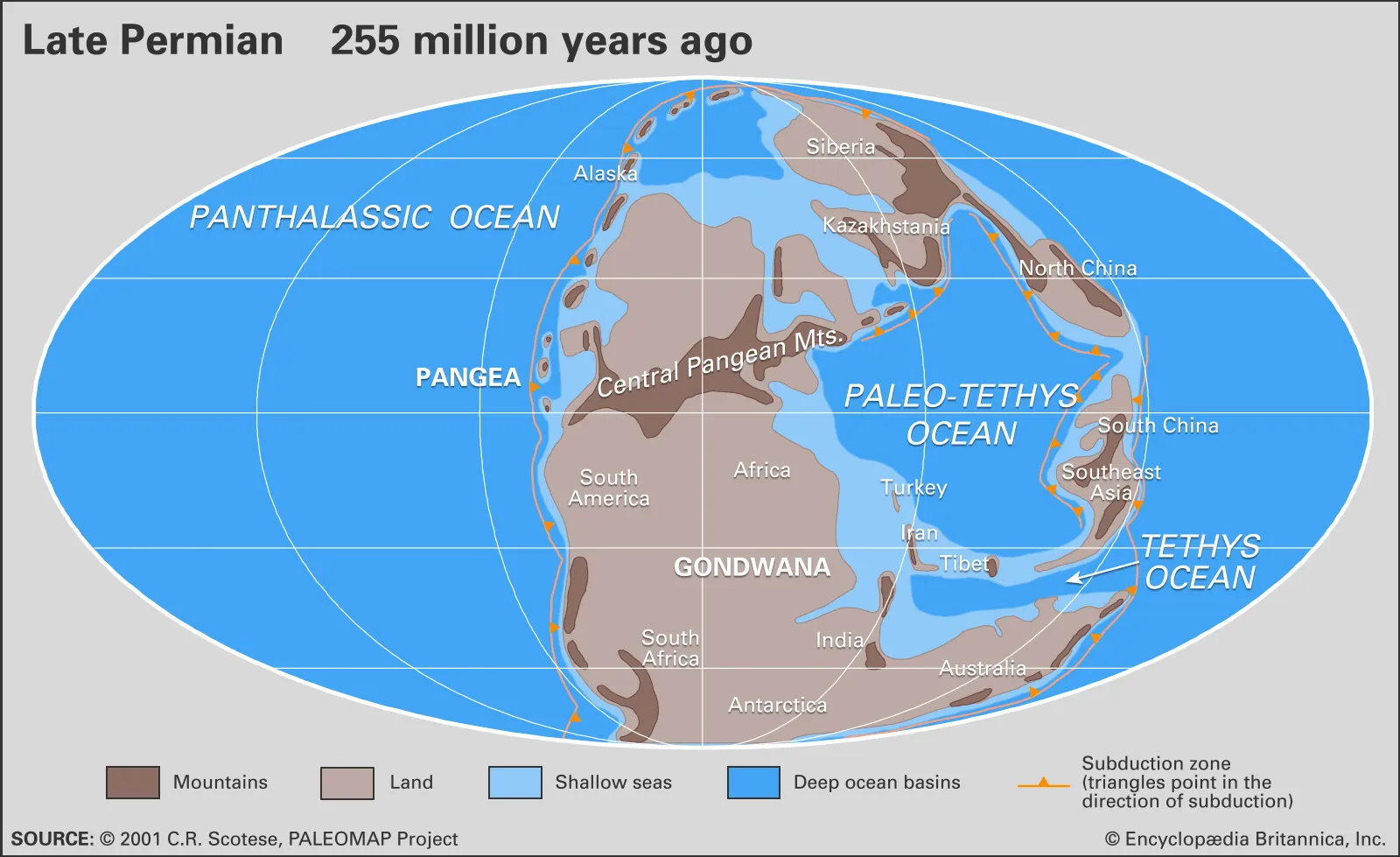
Pangea was the most recent supercontinent in Earth’s 4.5-billion-year history—a time when all landmasses were joined together as one. In the early 1900s, German geologist Alfred Wegener proposed this radical idea after noticing how the east coast of the Americas and the west coasts of Europe and Africa fit together like puzzle pieces, suggesting continents had once been connected and later drifted apart. Though controversial at first, his theory became the foundation of modern plate tectonics, and scientists have since identified even older supercontinents. Pangea itself began forming around 300 million years ago during the late Carboniferous, when the northern landmass Laurasia collided with the southern Gondwana, creating a C-shaped continent that wrapped around the ancient Tethys Ocean.
The Evidence for Pangea
Beyond the puzzle-like fit of coastlines, multiple lines of evidence show that Pangea once existed. When Laurasia and Gondwana collided, they formed the Central Pangean Mountains—an equatorial range comparable to the Himalayas—whose remnants today appear in the Appalachians, Atlas Mountains, and Scottish Highlands, revealing a shared geological history across now-distant lands. Fossils provide equally compelling proof: the pig-sized reptile Lystrosaurus is found in Africa, India, and Antarctica, while the freshwater Mesosaurus appears only in Brazil and West Africa despite being unable to cross oceans, and plant fossils like Glossopteris are scattered across southern continents. Together, these patterns only make sense if these regions were once connected, since the alternative—that identical species evolved separately or somehow crossed vast oceans—is far less plausible.
The End of Pangea
The Newark Supergroup
Schoch and Sues, 2013
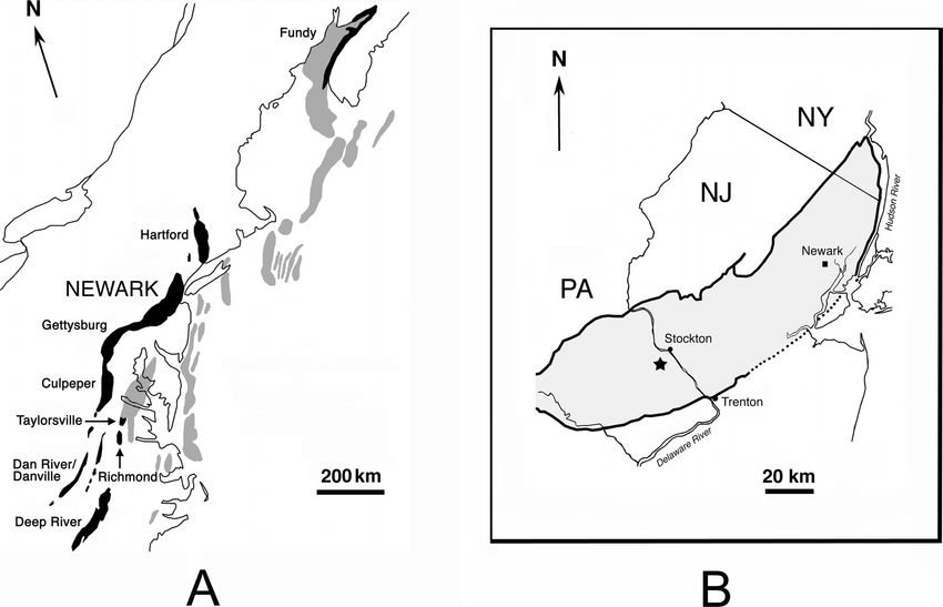
The Newark Supergroup is one of the clearest geological scars left behind by the breakup of Pangea, stretching over 1,300 miles from the Carolinas to Nova Scotia and covering more than 33,000 square miles. Formed around 230 million years ago as North America began pulling away from Africa, these basins are essentially “stretch marks” in the crust—long, narrow depressions created by extensional forces. Many are classified as aborted rifts, meaning they began to split but never developed into full ocean basins. Structurally, they are mostly half-grabens, where movement along a single major fault caused the land to tilt as it dropped, creating a steep faulted side (typically to the northwest) and a gentler slope to the southeast where sediments accumulated over time. These basins didn’t form uniformly; instead, they’re divided into southern, central, and northern segments, each with its own history. In the south, rifting was intense but short-lived, ending by the late Triassic, while farther north, rifting continued into the Jurassic, deepening the basins enough for seawater from the Tethys Ocean to flood in, leaving behind marine deposits like salt and limestone.
The Newark Basin in New Jersey offers a detailed window into this process, preserving nearly 20,000 feet of sedimentary and igneous rock that record the evolution of the landscape. The lowest layer, the Stockton Formation, reflects an early, high-energy environment dominated by braided rivers depositing coarse sandstones and conglomerates, evidence of rapid erosion and sediment transport from nearby highlands. Above it, the Lockatong Formation marks a shift to deeper, more stable lake environments, where fine-grained shales and mudstones accumulated in low-oxygen waters rich in organic material. These deposits form repeating Van Houten cycles, recording fluctuations between deep and shallow lake conditions driven by long-term climate changes. At the top, the Passaic Formation reveals another transformation: red mudstones, mud cracks, and evidence of well-oxygenated conditions point to a drier climate with shallow, temporary lakes and exposed floodplains. Together, these layers show how the breakup of Pangea not only tore the continent apart physically, but also reshaped regional environments and climate over time.
The Central Atlantic Magmatic Province
Magma plays a crucial role in the story of Pangea’s breakup, adding a violent volcanic dimension to the sedimentary record of the Newark Supergroup. While formations like the Stockton, Lockatong, and Passaic were built from compacted sands and muds, they are cut through by evidence of intense igneous activity. A striking example is the Palisades along the Hudson River, where a 600-foot cliff formed around 200 million years ago as magma forced its way into cracks created by rifting. This intrusion, known as the Palisades Sill, cooled slowly beneath the surface into a dense igneous rock called diabase, remaining buried for millions of years until erosion exposed it. Not all magma stayed underground, however. Some erupted onto the surface in massive fissure eruptions, forming the Watchung Mountains of northern New Jersey. Instead of volcanic cones, sheets of basalt poured from long fractures in three major pulses, spreading across the landscape and eventually solidifying into thick layers of rock. Though only about 500 square miles remain today, these lava flows once covered over 2,000 square miles, later reshaped by tectonic folding and glacial forces, including the formation of Glacial Lake Passaic during the Ice Age.
These local volcanic features are part of a much larger and more dramatic event known as the Central Atlantic Magmatic Province (CAMP), the largest igneous province on Earth. Covering roughly 11 million square kilometers—about the size of the United States and Canada combined—CAMP represents a massive outpouring of magma tied directly to the breakup of Pangea. Its remnants are scattered across multiple continents, including North America, South America, Africa, and Europe, preserving a global record of this tectonic upheaval. Along the eastern United States, these basalts appear throughout the Newark Supergroup, from the North Mountain basalts in Nova Scotia to the Deerfield basalts in Massachusetts and the Hickory Grove basalts in Virginia. Each eruptive pulse may have lasted less than a century, but together they spanned roughly 600,000 years, releasing staggering volumes of lava. This wasn’t just regional volcanism—it was a planetary-scale event that reshaped continents, altered climates, and marked one of the most significant geological turning points in Earth’s history.
The Mid-Atlantic Ridge

Founder