
The Forgotten Indigenous War at Kilauea
Oct 05, 2026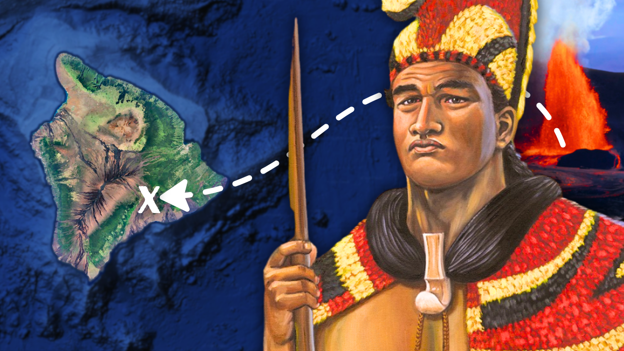
By: Greg Schmalzel
You’ve probably seen the videos of Kilauea’s most recent eruptions. If not, the Hawaiian volcano just finished its 54th eruption episode since 2024. Each episode never ceases to amaze me with its spectacular fountains of glowing lava. But Kilauea has a much deeper history - one that’s steeped in indigenous tradition.
On the southern flank of the volcano, you can find something strange that speaks to that history. Human footprints. They weren’t freshly sunken into sand, but preserved in volcanic rock. They were left by people walking across this landscape hundreds of years ago. And according to a long-standing story, some of those people were warriors.
Because in 1790, Kilauea erupted in the middle of a war. Hawaiʻi was not yet a unified kingdom. Powerful chiefs were fighting for control of the island, including Kamehameha and his rival, Keōua. In the midst of the conflict, the massive eruption rose from the summit. What happened next might have changed the history of Hawaii forever. And the indigenous folklore surrounding events like this is eerily accurate to what happened geologically.
So let's jump into it.
For the full YouTube video, click HERE.
Click here to subscribe to my FREE Newsletter for more.
Hawaii’s Volcanic History
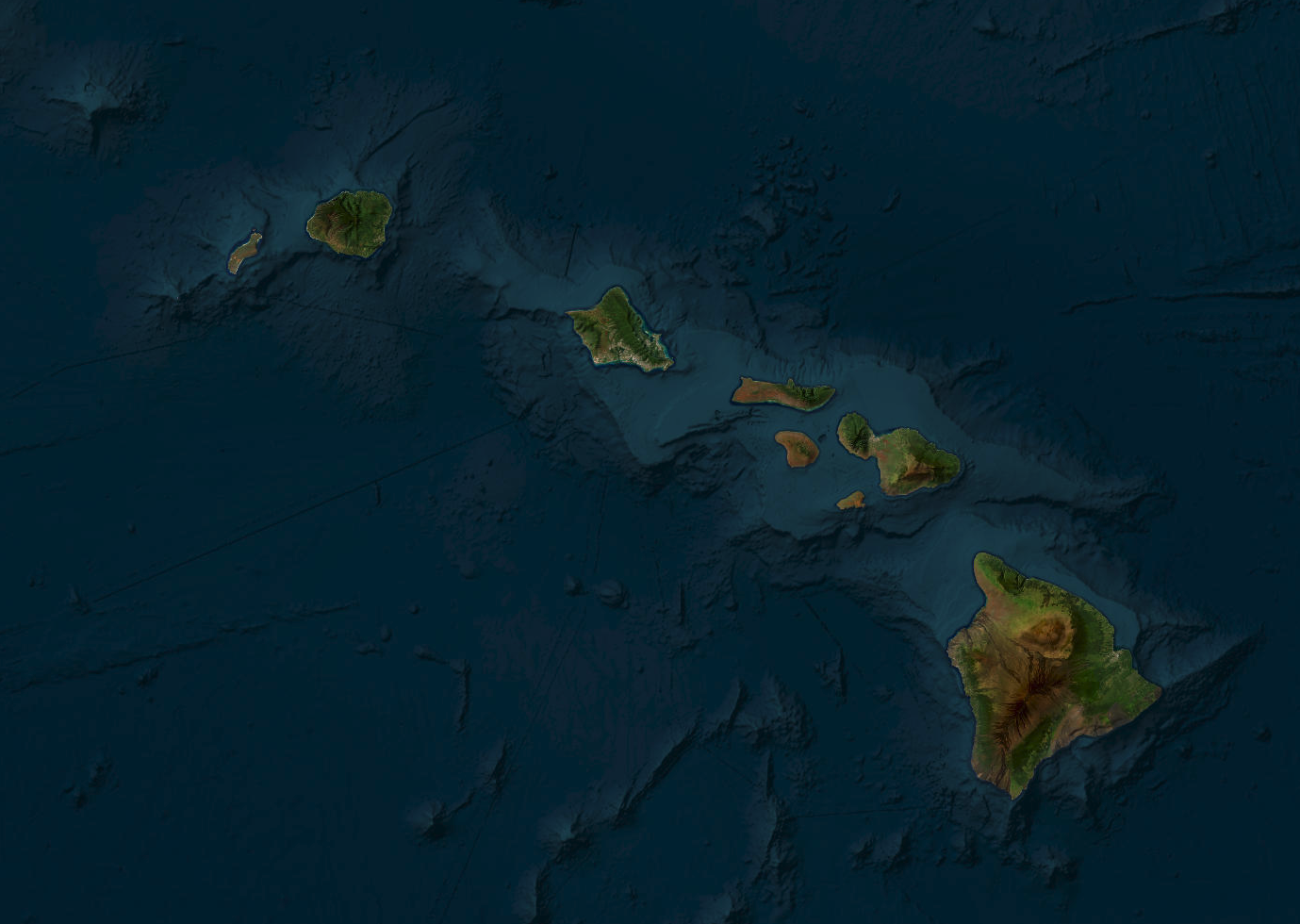
Hawaii was built by volcanoes over millions of years. The islands sit on the Pacific Plate, which slowly moves northwest over a stationary hotspot - a source of rising magma beneath the Earth’s crust. As the plate moves, new volcanoes form above the hotspot, leaving a trail of islands behind. Kauai is about 5 million years old, while the Big Island is less than 500,000 years old and still sits over the hotspot. The Big Island contains five shield volcanoes, including massive Mauna Loa and its smaller but famously active neighbor, Kīlauea.
Indigenous Hawaiians and the Lore of Kīlauea
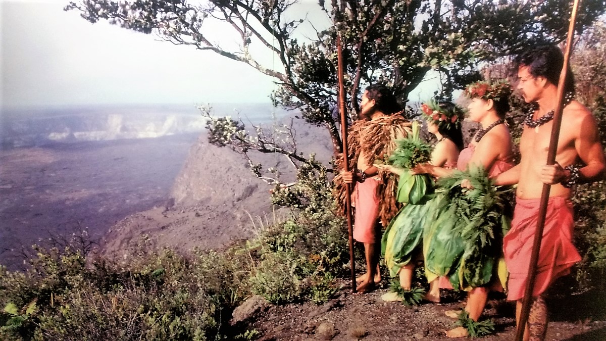
Unlike the steep, cone-shaped volcanoes most people imagine, Kīlauea is broad and low-profile. At its summit is a massive depression called a caldera, containing the smaller and highly active pit crater of Halemaʻumaʻu. Because Kīlauea is fed by fluid basaltic magma, lava can move through underground pathways called the East Rift Zone and Southwest Rift Zone, traveling miles from the summit before reaching the surface.
Most of the time, Kīlauea is an effusive volcano, producing relatively gentle lava flows rather than explosive eruptions. But it has a more dangerous side. When the summit collapses and drops toward the deep groundwater beneath the volcano, water can interact with hot volcanic material and trigger explosive phreatomagmatic eruptions. Evidence suggests these violent episodes occurred repeatedly in the past, including a major period of explosive activity lasting roughly 1,200 years.
This volcanic history is especially important when we consider Indigenous Hawaiian traditions. Before written language, Native Hawaiians preserved history, genealogy, environmental knowledge, and observations through chants (oli), songs (mele), and stories (moʻolelo). At the center of many traditions surrounding Kīlauea is Pele, the goddess associated with fire and volcanoes and, according to tradition, a creator of the Hawaiian Islands.
Pele is portrayed as both destructive and creative: her lava can destroy forests and settlements, but the volcanic landscape eventually becomes fertile ground for new life. Some researchers believe these stories may preserve memories of real eruptions.
G.E. Ulrich, USGS
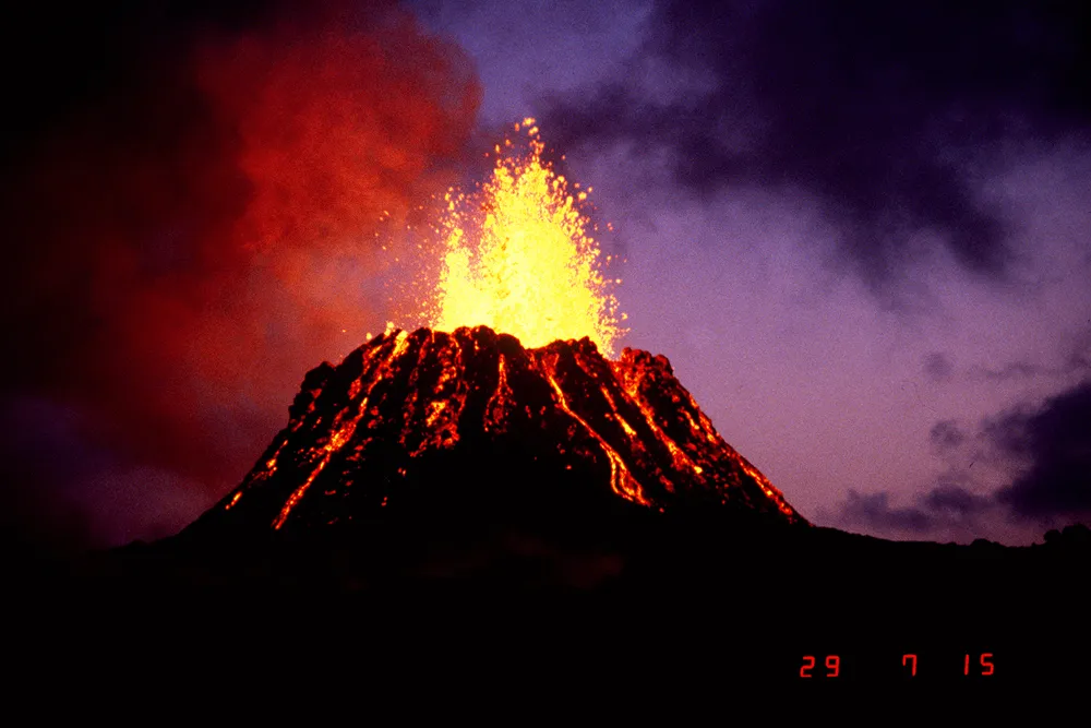
For example, geological evidence indicates that a massive lava flow destroyed roughly 430 square kilometers of land around the 15th century. Its timing and location closely correspond with Hawaiian traditions describing Pele destroying a forest. Other stories may preserve memories of the collapse that created Kīlauea’s modern caldera.
Whether every detail represents a literal geological event is impossible to know. But the remarkable overlap between oral traditions and geological evidence shows that volcanic activity was deeply embedded in Hawaiian history - and that would become important when conflict eventually reached the island.
The War in 1790

By the late 1700s, Hawaiʻi was divided among powerful chiefs. After a series of conflicts, Kamehameha controlled much of western Hawaiʻi, while his cousin Keōua held territory in the south and east. Their rivalry continued for years without a decisive victory.
In 1790, while Kamehameha was away fighting on Maui, Keōua attacked his territory. Kamehameha returned, forcing Keōua’s army south toward Kaʻū. Along the way, Keōua’s warriors stopped near Kīlauea’s summit. That night, earthquakes shook the area. The next morning, Keōua divided his forces into three groups.
Soon after, Kīlauea erupted violently, releasing enormous amounts of volcanic gas, steam, ash, and rock. One group was caught directly in the eruption and was killed. Another followed behind and crossed the fresh volcanic ash, leaving footprints that were eventually preserved.
The eruption did not win the war by itself, but it weakened Keōua’s forces at a critical moment. More importantly, many Hawaiians interpreted the disaster spiritually. Because the eruption struck Keōua’s army, it was seen as evidence that Pele had chosen Kamehameha’s side.
Keōua remained Kamehameha’s final major rival until 1791, when he was killed during a meeting at Kawaihae. Kamehameha then gained control of Hawaiʻi Island and eventually united most of the Hawaiian Islands under his rule. Kīlauea had not decided the war—but it had helped shift both the military and spiritual balance of power.
There are no firsthand written accounts of the 1790 disaster, and most descriptions were recorded decades later. Estimates of the death toll range from dozens to as many as 800, but the event was clearly devastating. Modern geology provides remarkable support for these accounts. Researchers identified three distinct layers within Kīlauea’s volcanic deposits, revealing multiple stages of the eruption: wet ash that preserved the famous footprints, a massive ash cloud that rose miles into the atmosphere, and finally fast-moving pyroclastic flows of scorching gas, ash, and rock. These flows likely caused most of the deaths, reconstructing the disaster like a geological crime scene.
Could an Eruption like this Happen Again?
USGS
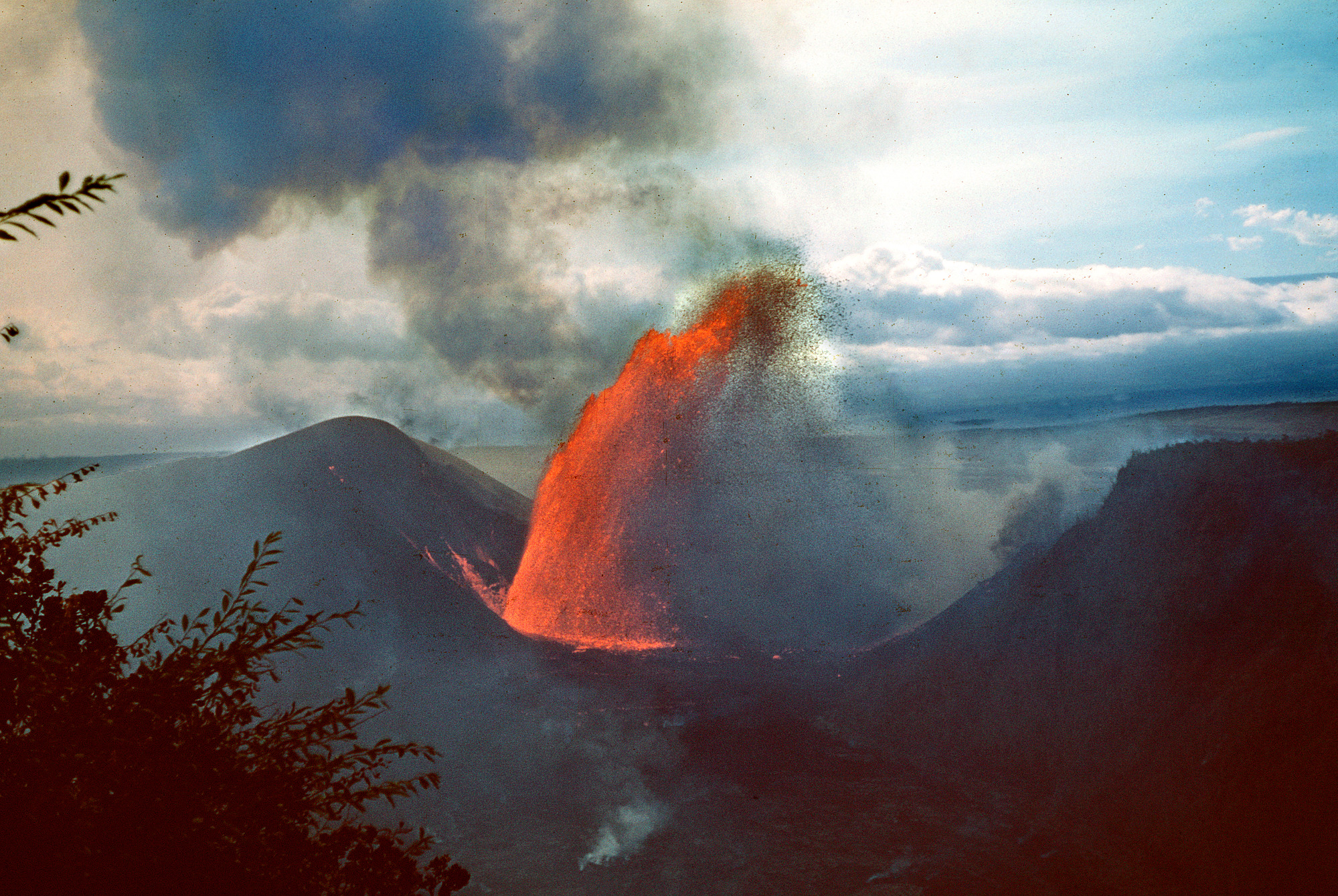
The answer is essentially yes. Geological evidence shows that Kīlauea has repeatedly produced violent, steam-driven eruptions when magma interacted with groundwater. Explosive activity was especially common between about 1500 and 1800 CE, while the gentle lava flows we associate with Kīlauea today represent only part of its recent history.
One potential warning sign is a major collapse of the summit. In 2018, Kīlauea experienced its largest summit collapse in at least 200 years. As magma drained toward the Lower East Rift Zone, the summit floor collapsed more than 60 times, earthquakes numbered in the tens of thousands, and the caldera deepened by more than 1,600 feet. Thankfully, the feared explosive transition never occurred.
The eruption was still devastating. Lava covered more than 8,700 acres, destroyed over 700 structures, buried roughly 30 miles of roads, and produced enormous amounts of sulfur dioxide. It also created about 875 acres of new land along the coast.
Today, Kīlauea remains closely monitored. Its magma system is still active, but conditions have not produced the same explosive behavior seen in 1790. The lesson of Kīlauea is clear: Pele may be quiet, but she is never truly gone.
Sources:
[1] Geology and History of Kīlauea
[2] Wilmshurst, J., et al. 2011. “High-precision radiocarbon dating shows recent and rapid initial human colonization of East Polynesia.” Proc. Natl. Acad. Sci. U.S.A. 108(5):1815-1820.
[3] Pele
[4] Emerson, N. 1915. Pele and Hiiaka: a myth from Hawaii. Honolulu Star-Bulletin. (Revised edition by ‘Ai Pōhaku Press, Honolulu, 1993.).
[5] Swanson, D. A. 2008. “Hawaiian oral tradition describes 400 years of volcanic activity at Kīlauea.” Journal of Volcanology and Geothermal Research, 176(3):427-431.
[7] Kamehameha Begins His Bid for Power
[8] Swanson, D. A., et al. 2014. “Reconstructing the deadly eruptive events of 1790 CE at Kīlauea Volcano, Hawai’i.” Geological Society of America Bulletin, 127(3-4):503–515.
[9] 2018 lower East Rift Zone Eruption and Summit Collapse at Kīlauea
[10] Keonehelelei - "The Falling Sands" Footprints Archaeological Site. United States National Park Service
Founder