The Forgotten First Settlers of New England
Jun 29, 2026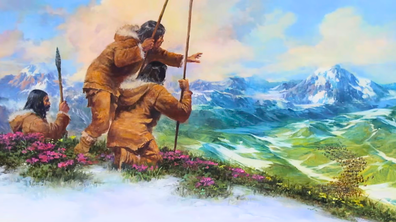
By: Greg Schmalzel
Sitting under an elaborate portico on the waterfront of Plymouth, Massachusetts, sits a granite boulder inscribed with the year 1620. This is Plymouth Rock and its legendary status far exceeds its physical presence and even its historical accuracy. It supposedly marks the Pilgrims first arrival in the region, but there’s actually no contemporary evidence to prove this. In fact, they made landfall on Cape Cod before settling in Plymouth, and no early accounts mention a rock at all. The lore emerged in 1741, when an elderly resident claimed it as the landing site based on secondhand oral tradition. The date of 1620 wasn’t actually carved until 1880. Since then, the rock has been moved, broken, chipped apart by souvenir hunters, trimmed to fit monuments, and repeatedly reassembled. What remains is just a fragment of what it once was.
Despite its complicated past, this broken stone has come to represent the beginning of history in New England. But that story is incomplete. Because the first pilgrims to land here didn’t actually discover anything new. They rediscovered a land that was already settled by people thousands of years earlier. And they had their own history, myths, and ways of life. Populations of Native Americans had been traversing New England for generations. Though they didn’t have maps, they had a deep understanding of this landscape. They were deeply connected to its forests, mountains, rivers, and beaches - where they hunted, slept, and laughed together. The earliest traces of these people are hard to unravel because they didn’t leave behind big monuments or written records. What they left behind were fragments of stone tools, fire pits, and other fleeting remains. And unlike Plymouth Rock… most of their world is buried and hidden from sight. But with some archaeological efforts, we have begun to unearth that buried world and it tells some fascinating tales.
This is the story of the first New Englanders and the Ice Age landscape they called home.
For the full YouTube video, click HERE.
The Land of New England's Past
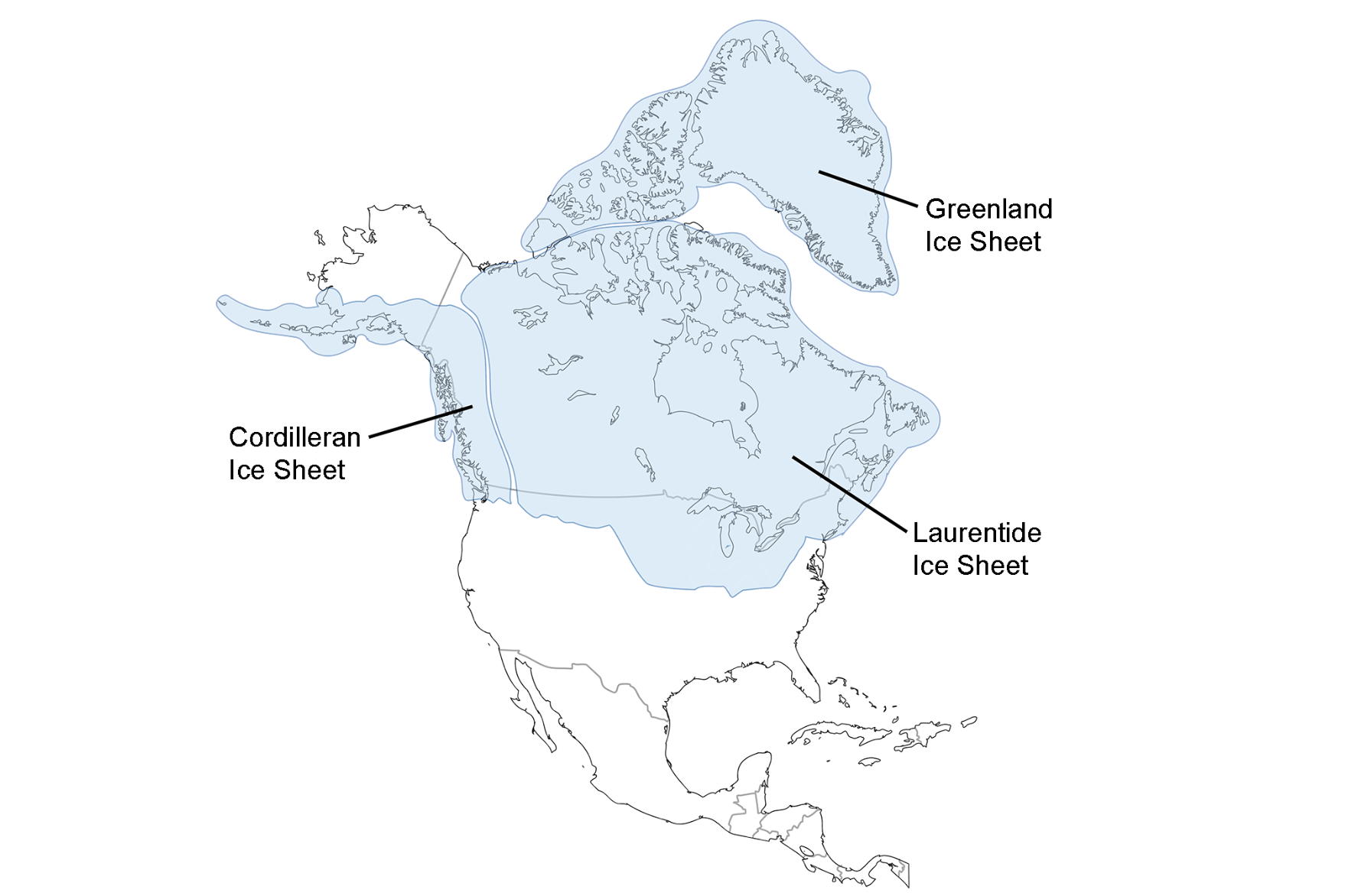
Around 20,000 years ago, New England looked nothing like it does today. During the most recent phase of the Wisconsinan Glaciation, a massive ice sheet known as the Laurentide advanced southward from Canada, blanketing the entire region. Under immense pressure, this moving wall of ice acted like sandpaper—stripping away soil, carving into bedrock, and reshaping the land beneath it. At its peak, the glacier extended beyond the present coastline, depositing sediment that would later form features like Long Island, Cape Cod, Martha’s Vineyard, and Nantucket.
As the climate warmed, the glacier began to retreat northward, leaving behind vast amounts of boulders, gravel, sand, and clay. This process reshaped the landscape, smoothing mountain ranges, carving river valleys, and filling lakes across New England. The newly exposed terrain quickly became a corridor for life: herds of animals followed the shifting ice edge, and humans soon followed them. These ice-free zones created rich hunting grounds and marked the first opportunity for people to enter the region—setting the stage for the earliest human presence we can trace in the archaeological record, even if that record will always remain incomplete.
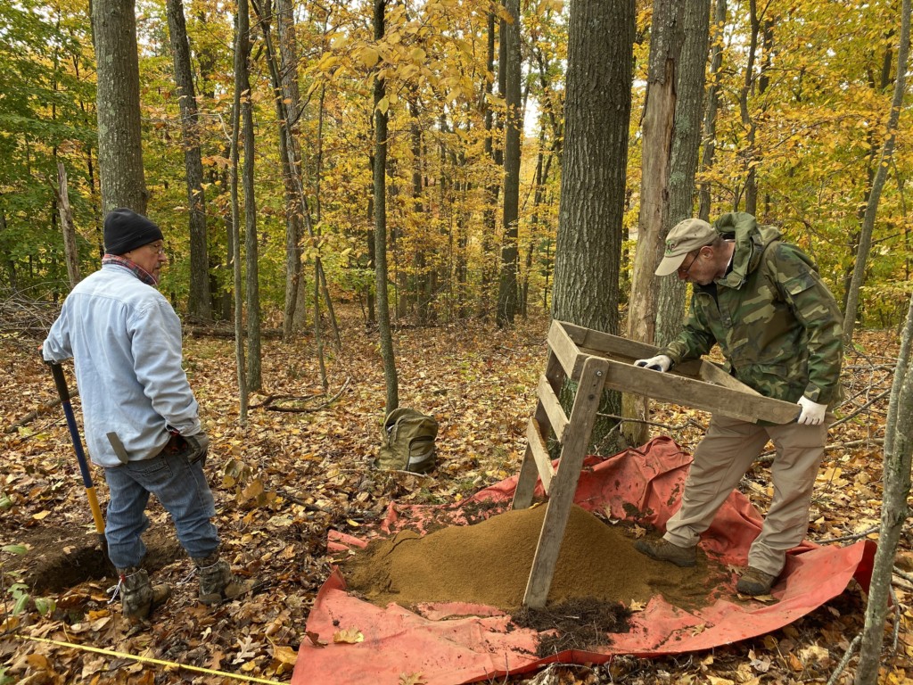
Connecticut: The Brian D. Jones Site
Avon Historical Society
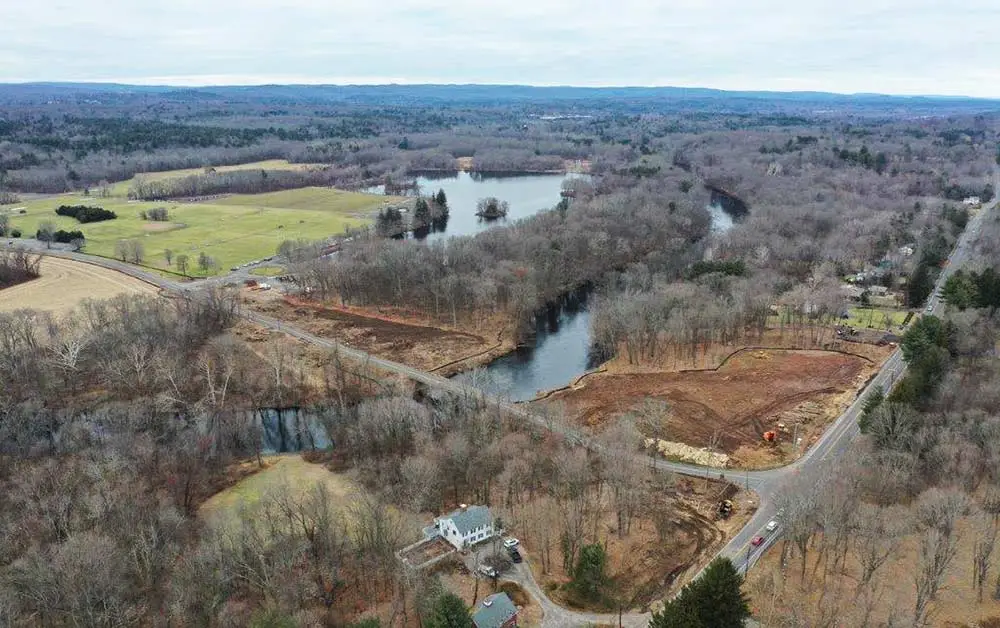
Starting in the southwest, Connecticut was likely one of the first parts of New England to emerge from beneath the ice. Its oldest known archaeological site, the Brian D. Jones site in Avon, was discovered in 2019 during a pre-construction survey along the Farmington River. Earlier work in the area had identified a much later Woodland period occupation, but deeper testing—guided by ground-penetrating radar and LiDAR—revealed a buried Ice Age landscape. This ancient floodplain formed around 16,000 years ago after a glacial lake drained, leaving behind elevated riverbanks that offered ideal ground for early human camps.
Five to seven feet below the surface, archaeologists uncovered evidence of at least two Paleoamerican occupations dating to about 12,500 years ago. Hearths, burned bone, and over 15,000 stone tools—including scrapers, gravers, and a fluted point fragment—paint a picture of short-term hunting camps. Many of these tools were made from non-local materials like Normanskill chert, Hardyston jasper, and Mount Jasper rhyolite, suggesting long-distance movement or exchange networks. Repeated flooding along the river slowly buried and preserved these occupations, reminding us that the earliest chapters of New England’s human story are often hidden deep beneath the surface.
Rhode Island Nomads
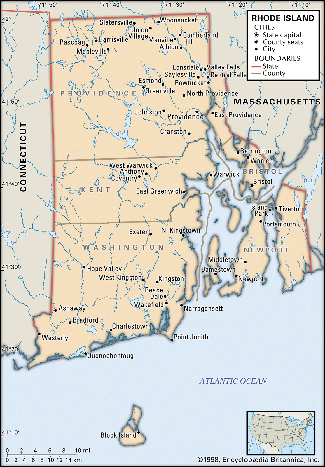
To the east, Rhode Island offers far more limited evidence of Ice Age occupation. As the smallest state in the U.S., its Paleoamerican record is sparse, consisting mostly of small sites and scattered finds. A few locations like the Potowomut and Twin Rivers sites are known, but published research is limited. Instead, much of the earliest evidence comes from isolated surface finds, such as fluted projectile points discovered in places like East Providence. While these lack datable context, their distinctive fluting technology—used to create a channel at the base—anchors them in a well-established timeframe shared across North America.
Fluted points appear between roughly 14,000 and 13,000 years ago and largely disappear by 10,000 years ago, allowing archaeologists to reasonably date Rhode Island’s earliest artifacts despite poor preservation. The scarcity of evidence here is likely not due to a lack of human presence, but to a combination of factors: the state’s small size, dense modern development, and dramatic post-glacial sea-level rise. When the first people arrived, the coastline extended miles farther than it does today, meaning many early sites now lie submerged offshore or have been lost to erosion—leaving behind only fragmentary clues of the region’s earliest inhabitants.
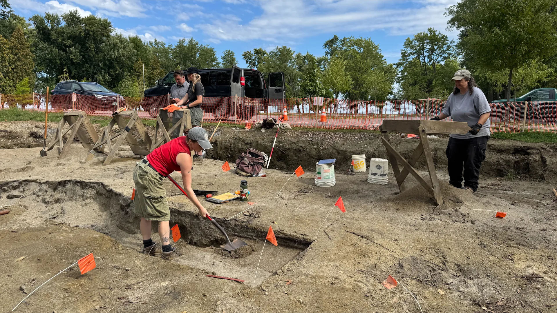
Two Sites in Massachusetts
Jennifer Ort
Moving north into Massachusetts, two sites—Bull Brook and the Sands of the Blackstone—offer a striking contrast in how early people lived in post-glacial New England. Together, they show that Paleoamerican lifeways were far from uniform. Bull Brook reflects large-scale social gathering, while the Sands of the Blackstone captures a quieter, more intimate snapshot of daily survival within a coastal river system.
The Bull Brook site in Ipswich stands out as one of the clearest examples of a large communal Paleoindian camp. Spread across a sandy plain, it contains 36 artifact clusters arranged in a broad circle, all likely part of a single occupation. The layout reveals organized activity zones: interior areas focused on stone tool production, while outer rings were used for hide processing. Archaeologists believe this site was a planned aggregation for intercepting migrating caribou herds, supported by the presence of caribou remains. It represents a rare glimpse of coordinated group behavior on a large scale.
In contrast, the Sands of the Blackstone site—discovered in 2010 along an elevated ridge of the Blackstone River—tells a more modest story. With just a handful of artifact clusters, it reflects small-group foraging and tool maintenance rather than large gatherings. One standout artifact, a refashioned fluted point made of clear quartz, suggests resourcefulness after a failed hunt. Despite these differences, both sites date to the late Pleistocene and share similar long-distance stone sourcing networks, linking them to a broader regional system. Ultimately, Bull Brook preserves a moment of collective strategy, while the Blackstone site captures the adaptability and resilience of individuals on the landscape.
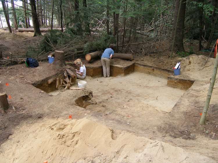
Vermont: The Reagan Site
As we tread into into Vermont, the landscape becomes more rugged, and the Reagan Site reflects this dramatic setting. Perched on a terrace within the Missisquoi River valley, it overlooks the Green Mountains—once far more barren in the wake of the Ice Age. What makes this site especially intriguing is its unusual artifact assemblage. Alongside typical fluted Paleoamerican points are distinct, unfluted Cormier-Nicholas points, suggesting a transitional phase in stone tool technology. Even more surprising are carved steatite (soapstone) pendants—an unprecedented find for this early period, hinting at symbolic or ornamental behavior not commonly associated with Paleoamerican groups.
The site also appears to have functioned as a quarry, with a unique material known as “Reagan chert” making up a large portion of the tools recovered. This sets it apart from most New England sites, where people relied on stone transported from distant sources. Adding to its significance, the Reagan Site once sat near the shoreline of the Champlain Sea—a now-vanished inland sea that supported marine life like beluga whales. This dynamic coastal environment would have offered abundant resources, placing people at the intersection of mountains, sea, and raw material. At the Reagan Site, geology and human activity converge, preserving one of the most distinctive snapshots of early life in New England.
New Hampshire: The Tenant Swamp Site
In New Hampshire, the Tenant Swamp site in Keene offers a remarkably intact glimpse into life near the end of the Ice Age. Situated on a glacial outwash terrace formed around 15,000 years ago, the site was later covered by wind-blown sands during the Younger Dryas cold period. These well-drained, sandy soils discouraged later agriculture, while shifts in the nearby Ashuelot River reduced its appeal to later populations—allowing the Paleoamerican deposits to remain largely undisturbed. Excavations revealed four oval concentrations of artifacts interpreted as the floors of small, skin-covered tents, each large enough to house family groups. Within them, clusters of burned bone and tools centered around hearths suggest tightly organized living spaces, with little activity beyond the shelter interiors.
These patterns point to a winter encampment during the harsh Younger Dryas, when temperatures in the region returned to near-glacial conditions. Despite the extreme environment, the site reflects resilience and adaptation, supported by a toolkit dominated by high-quality stone sourced from afar, including Munsungun chert and Mount Jasper rhyolite. As seen across New England, these recurring materials hint at expansive movement or exchange networks, raising questions about how far these groups traveled and how they organized access to critical resources. Long before modern industry, these early inhabitants were already mastering the landscape—identifying, acquiring, and distributing the raw materials essential for survival.
Munsungun from Maine and the Vail Site
Kitchel, N., et al. 2020.
Munsungun chert, one of the most prized materials of the Paleoamerican world, originates from northern Maine’s Munsungun Lake formation—an ancient volcanic deposit dating back over 440 million years. Its smooth, glass-like texture made it ideal for crafting sharp, reliable tools, and it became widely used across New England. While most chert appears in gray or black, rarer red and green varieties seem to have been selected for their visual appeal rather than function. The recently identified NKP quarry shows that this material remained valuable long after the Paleoamerican period, with evidence of Archaic peoples extracting red chert as recently as 7,700 years ago. This continuity highlights a deep, enduring knowledge of the landscape and its resources.
Maine’s oldest known site, however, is the Vail site, dating to roughly 12,700 years ago. Located along an ancient channel of the Magalloway River, it functioned as a highly organized caribou hunting system. A residential camp and nearby kill site worked in tandem, where hunters ambushed migrating herds at a natural choke point. Archaeologists even refitted broken spear points found at both locations, confirming their simultaneous use. Yet this efficiency raises a provocative question: could such success have led to overhunting? Some researchers suggest that intensive harvesting may have contributed to local herd collapse, tying into the broader “overkill hypothesis,” which proposes that early humans played a major role in the extinction of North America’s Ice Age megafauna.
Sources:
[1] The Real Story Behind Plymouth Rock
[2] Ansley, J. 2000. “The Teacher-Friendly Guide to the Geology of the Northeastern U.S.” Arnold Printing Corp. Ithaca, NY.
[3] Leslie, D., et al. 2020. “The Brian D. Jones Site (4-10B): A Multi-Component Paleoindian Site in Southern New England.” PaleoAmerica 6(2):199–203.
[4] Discovering of the Brian D. Jones Paleoindian Site
[5] RHODE ISLAND HISTORICAL PRESERVATION & HERITAGE COMMISSION. 2002. Native American Archaeology in Rhode Island.
[6] Robinson, B., et al. 2009. “Paleoindian Aggregation and Social Context at Bull Brook.” American Antiquity 74(3):423–447.
[7] Leveillee, A. 2016. Sands of the Blackstone: A PaleoIndian Site in the Narragansett Bay Drainage.
[8] Robinson, F., 2008. “The Reagan Site: A Reanalysis, Recontextualization, and Reappraisal of a Formative Northeastern Paleoindian Site.” Master's Thesis.
[9] Rockwell, H. 2014. “THE TENANT SWAMP SITE AND PALEOINDIAN DOMESTIC SPACE IN KEENE, NEW HAMPSHIRE.” Archaeology of Eastern North America 42:129–164.
[11] Kitchel, N., et al. 2020. “Red Chert Quarries in the Munsungun Lake Formation: Moving beyond Norway Bluff.” PaleoAmerica 6(2):169–180.
[12] Gramly, R. 1984. “KILL SITES, KILLING GROUND AND FLUTED POINTS AT THE VAIL SITE.” Archaeology of Eastern North America 12:110-121.
[13] Gramly, R. 2026. “THE VAIL HABITATION AND KILL SITE: IMPLICATIONS FOR LATE UPPER PALAEOLITHIC BEHAVIOR AND BAND SIZE.” American Society for Amateur Archaeology
Founder