
The Entire Geologic History of New England
Sep 07, 2026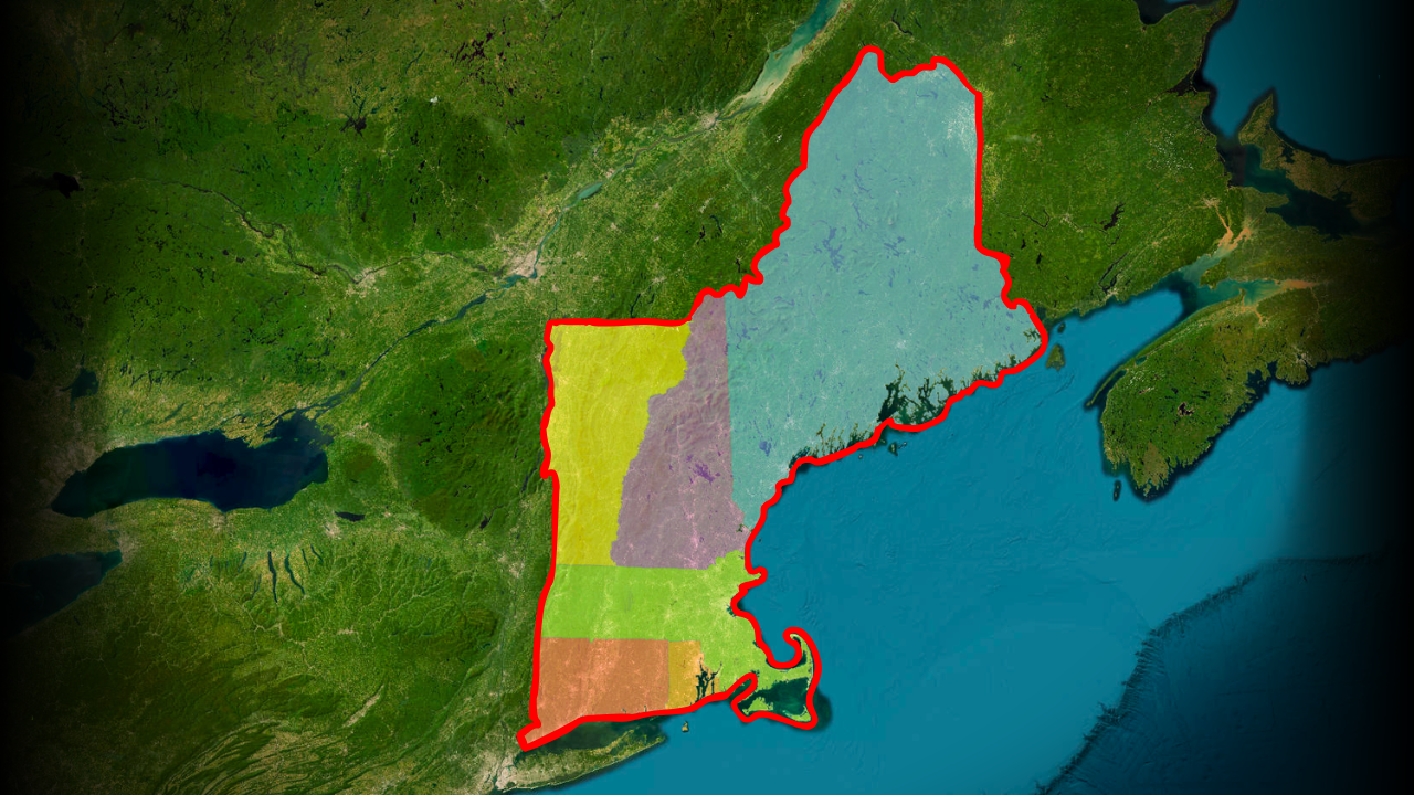
By: Greg Schmalzel
If you look at New England’s landscapes, it’s easy to imagine that the mountains and rolling hills have always been there. From the Green Mountains stretching through Vermont to the rocky coast of Maine, it all seems so permanent. But much of what you’re looking at didn’t even exist at one point. New England is a geological collage assembled over more than a billion years. It was built from fragments of ancient continents, volcanic islands, vanished oceans, and tectonic collisions. In this video, we’re going to travel through that entire story. We’ll begin with the ancient continental core that would become North America. Then, we’ll go chapter by chapter to see how New England was built up and ripped apart multiple times. And after hundreds of millions of years, glaciers sculpted whatever was left into the landscape we recognize today.
But there’s something strange about this story that I feel most people don’t know about. Many of the rocks beneath New England weren’t originally part of North America. Some traveled across vast oceans, from distant lands to get here. And they built a Frankenstein of a landscape. So to understand the place we know today, we have to reconstruct it from the ancient rocks that still remain.
For the full YouTube video, click HERE.
The Ancient American Core
P.A. Bourque
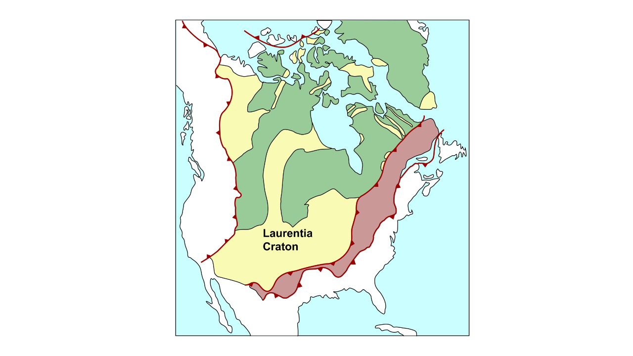
Before New England could form, there had to be a foundation for it to build upon. That foundation was Laurentia, an ancient continental landmass that eventually became the core of North America. It included the Canadian Shield and parts of what is now the United States. Around 1.3–1 billion years ago, Laurentia collided with another continent called Amazonia, helping create the supercontinent Rodinia. This massive collision, known as the Grenville Orogeny, compressed and heated the crust, forming an enormous mountain belt and producing vast amounts of igneous and metamorphic rock.
Most of those ancient mountains have since been eroded away, but their deep roots remain. In New England, rocks formed during the Grenville Orogeny—including banded metamorphic rocks called gneiss—are preserved in places such as the Green Mountains and Berkshire region. These rocks form some of New England's oldest foundations. But there's a catch: the mountains we see today came much later. And to understand how New England was eventually assembled, we first need to tear Amazonia away from Laurentia.
Rodinia and The First Breakup
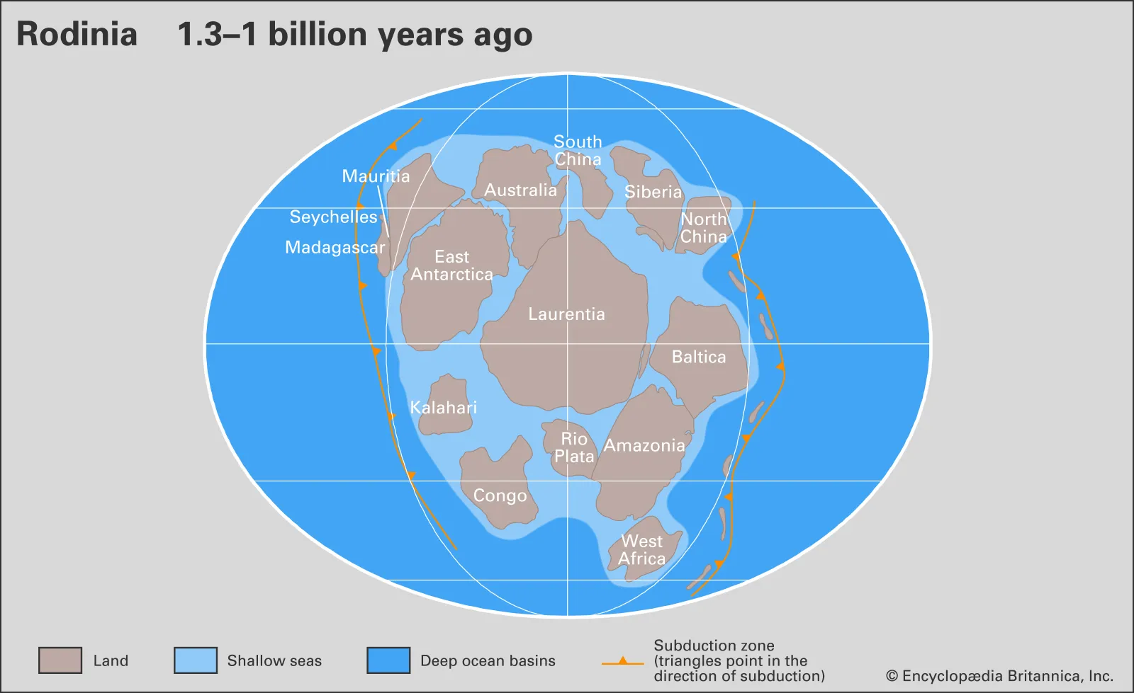
Around 700 million years ago, Rodinia began to break apart. Hot magma rose beneath the crust, stretching and thinning it until the land split into pieces. Molten rock filled the cracks, eventually creating the Iapetus Ocean and forming the early eastern edge of North America. New England still preserves evidence of this ancient breakup. Rocks such as greenstone in the Green Mountains began as lava that erupted during rifting. Elsewhere, magma cooled underground to form large bodies of granite.
As the new ocean widened, rivers carried enormous amounts of sand, mud, and silt off the continent and into the sea. Because this part of North America was near the equator, warm, shallow seas supported abundant microbial life. Their remains eventually became thick layers of limestone, which were later transformed into marble. Today, this ancient marble forms the New England Marble Belt, stretching from Vermont through Massachusetts into Connecticut. But the Iapetus Ocean wouldn't remain open forever. Another continental collision was coming—and this one would begin assembling New England.
Exotic Terranes
The Taconic Orogeny
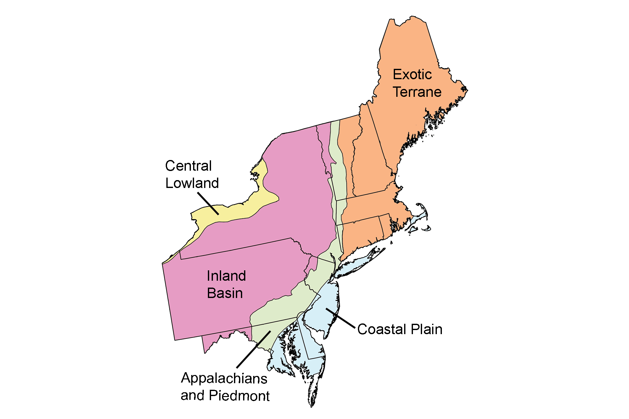
Around 450 million years ago, the Iapetus Ocean began closing. As oceanic crust was pulled into the mantle, volcanoes formed on a chain of islands offshore. Eventually, these volcanic islands collided with Laurentia and were accreted—welded onto the continent. The collision compressed, folded, and thrust enormous slabs of rock onto Laurentia, creating the first major Appalachian mountain range. This event also transformed older rocks, including limestone that was recrystallized into marble. The rising mountains shed huge amounts of sediment into a foreland basin to the west. Today, rocks from this collision make up much of Vermont, New Hampshire, Massachusetts, Connecticut, and Maine.
The Acadian Orogeny
The next major collision occurred around 400 million years ago, when another exotic landmass called Avalonia collided with Laurentia. Avalonia had broken away from the ancient supercontinent Gondwana and traveled thousands of miles northward before reaching North America. Its collision triggered the Acadian Orogeny, particularly affecting what is now coastal Maine and New England. The enormous pressure and heat melted parts of the crust, producing vast underground chambers of magma that eventually cooled into granite. Other rocks were buried and transformed into metamorphic rocks such as schist. The granite of Mount Desert Island and the rocks of New Hampshire's White Mountains are important remnants of this ancient collision.
The Alleghanian Orogeny
Around 320 million years ago, the final major collision began. This time, it wasn't an island chain or small microcontinent—it was Gondwana itself. Gondwana collided with Laurentia, helping assemble the supercontinent Pangea and finally closing the Iapetus Ocean. The collision produced enormous compressional forces that deformed rocks across the region. But New England already had a complicated geological history, so the Alleghanian Orogeny mostly overprinted what earlier collisions had created. Existing rocks were fractured, folded, faulted, and metamorphosed yet again. Rather than building an entirely new landscape, this final collision added another layer to New England's already complex geological history.
Pangea and the Second Breakup
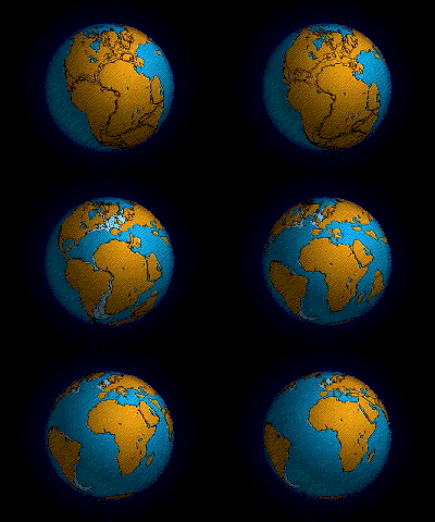
About 200 million years ago, Pangea began breaking apart, and Connecticut became one of the best places in New England to see the evidence. As the crust stretched and pulled apart, huge blocks of land dropped along faults, creating the Hartford Basin, an ancient rift valley. Rivers and rainfall filled the basin with layers of red mud, sand, and silt, while volcanic eruptions poured layers of basalt across the landscape.
These sediments also created ideal conditions for preserving dinosaur footprints. Dinosaurs walked across muddy lakeshores and floodplains, leaving impressions in soft sediment. New layers of sediment quickly buried those footprints, protecting them until they eventually hardened into rock. Today, Connecticut's dinosaur tracks provide a remarkable glimpse into this ancient world.
The rifting eventually succeeded, opening the Atlantic Ocean. New England's tectonic activity quieted, and for more than 100 million years, erosion—not collisions—became the dominant force shaping the landscape.
The Ice Age
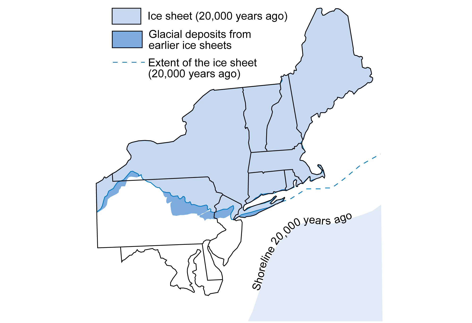
Beginning about 2.5 million years ago, the Pleistocene Ice Age brought repeated advances and retreats of enormous ice sheets across New England. At its peak around 20,000 years ago, the Laurentide Ice Sheet covered the region beneath ice up to two miles thick, grinding down mountains and pushing the Earth's crust downward under its immense weight.
As the glaciers moved, they plucked huge blocks of rock from the landscape and carried them south. When the ice melted, it dumped these rocks far from their original homes, creating the glacial erratics found throughout New England and beyond. The ice also transformed river valleys into broad, U-shaped valleys and carved dramatic notches through the mountains.
Much of the debris was eventually deposited along the glacier's southern edge, forming a massive terminal moraine. This helped create the sandy, rocky landscapes of Cape Cod, Martha's Vineyard, Nantucket, and Long Island.
In many ways, the New England landscape we recognize today is a product of the Ice Age.
Post-Ice Age New England
But New England still wasn’t finished. As temperatures rose after about 20,000 years ago, the Laurentide Ice Sheet slowly retreated, finally leaving the region around 11,000 years ago. The melting ice released enormous floods of water, sand, and gravel. In some valleys, this debris formed temporary dams that created huge glacial lakes. The largest, Glacial Lake Hitchcock, stretched more than 150 miles through the Connecticut River Valley. Over thousands of years, it deposited thick layers of fertile mud and silt across the valley floor.
Melting ice also left behind thousands of buried ice blocks. When they melted, the ground collapsed into bowl-shaped depressions called kettle holes, many of which filled with water to become ponds and lakes.
Meanwhile, the land slowly rebounded after being compressed beneath the ice, while rising seas flooded the coast. River valleys drowned, creating the islands and irregular coastline we see today. And by then, the first people were already exploring this newly exposed landscape.
Sources:
[1] Ansley, J. E. 2000, reprinted 2016. The Teacher-Friendly Guide to the Geology of the Northeastern U.S. Paleontological Research Institution, Ithaca, New York.
[2] Marshak, S. 2012. Essentials of Geology (Fourth Edition). W. W. Norton & Company.
[3] Geologic History of the Northeastern United States
[4] Faill, R. T. 1997. “A geologic history of the north-central Appalachians; Part 1, Orogenesis from the Mesoproterozoic through the Taconic Orogeny.” American Journal of Science, 297(6):551-619.
[5] Faill, R. T. 1997. “A geologic history of the north-central Appalachians; Part 2, The Appalachian Basin from the Silurian through the Carboniferous.” American Journal of Science, 297(7):729-761.
[6] Faill, R. T. 1998. “A geologic history of the north-central Appalachians; Part 3, The Alleghany Orogeny.” American Journal of Science, 298(2):131-179.
[7] Eusden, J. 2010. The Presidential Range: Its Geologic History and Plate Tectonics. Durand Press, NH.
[8] Shellnutt, J., et al. 2019. “Long-lived association between Avalonia and the Meguma terrane deduced from zircon geochronology of metasedimentary granulites.” Sci Rep 9, 4065.
[9] Hubert, J. and Feshbac, P. 1992. “The Triassic-Jurassic Hartford Rift Basin, Connecticut and Massachusetts: Evolution, Sandstone Diagenesis, and Hydrocarbon History.” (1). AAPG Bulletin, 76(11).
[10] Burke, K. 1976. “Development of graben associated with the initial ruptures of the atlantic ocean.” Tectonophysics, 36(1-3):93-112.
[11] Olsen, P., et al. 2003. “CAUSES AND CONSEQUENCES OF THE TRIASSIC-JURASSIC MASS EXTINCTION AS SEEN FROM THE HARTFORD BASIN.”
Founder